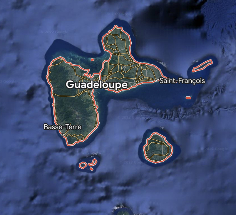
Over the years I’ve visited many volcanic islands certain ones do spring to mind for their lush green interiors. In the eastern Caribbean chain Guadeloupe is particularly enchanting. The land of running waters.
The one I spent some time visiting was one of the outer island of the canary group of La Palma. La Palma I believe has one of the largest volcanic rims or calderas in the world. I had the opportunity to go to the very top and visit the two U.K. astronomical observatories.
I was staying in the harbour of Tazacorte and most days I liked to walk up to the view point of Mirador Del Time. You can look down to the town of Los Llanos and see it’s Main Street stretching out into the distant skyline.
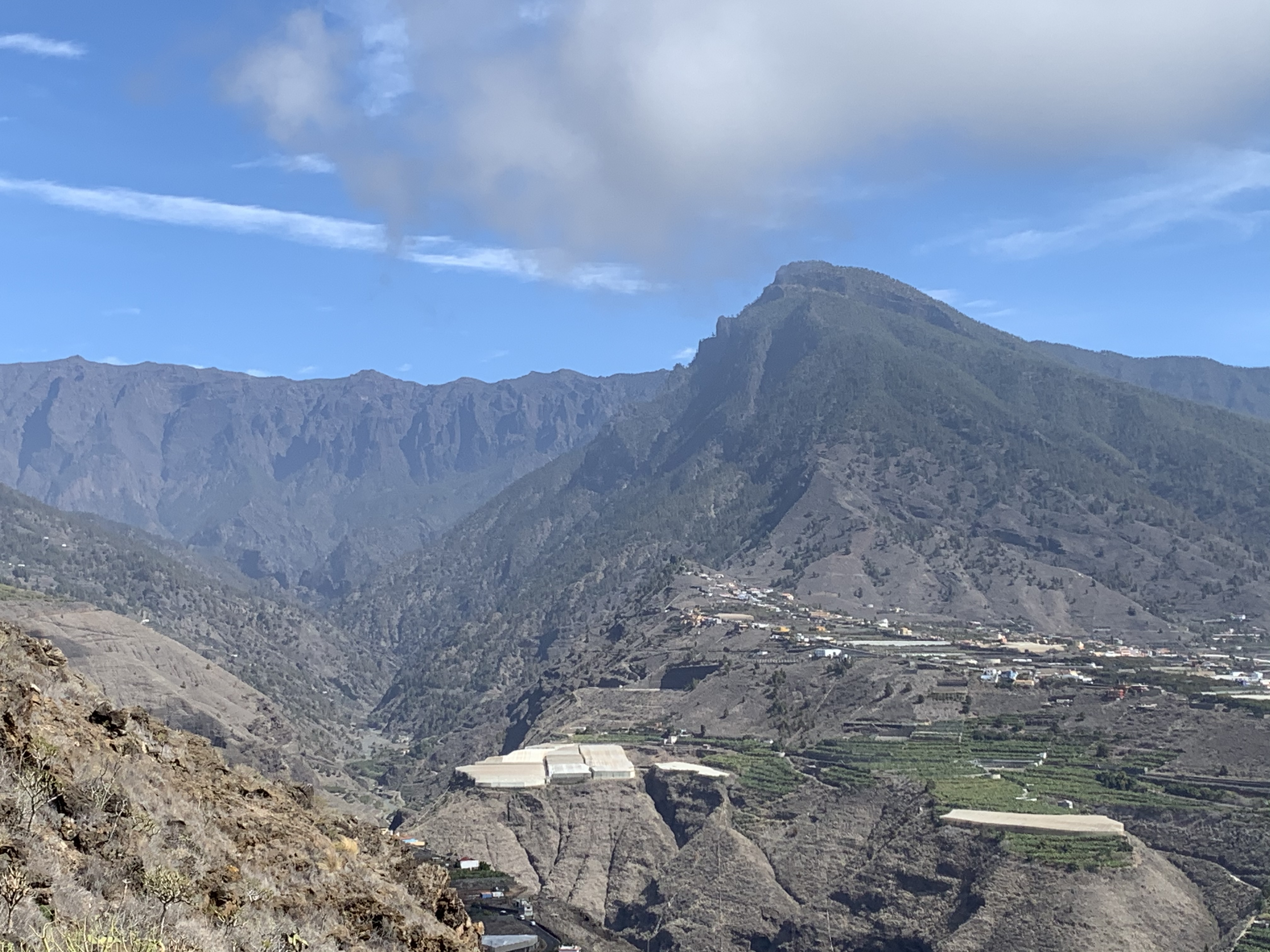
Recently in the southern part one of smallish volcanoes erupted. There was a local Spanish guy giving daily running commentary about the eruption and the damage the laver rivers were doing to the various banana plantations from viewing vantage point of Mirador Del Time.
Lava damage in La Palma
I’ve always thought that volcanoes are the safety valve to the interior magma core that release energy every so often at unpredictable times. One major benefits of living on the side of a volcanoes is the rich minerals that come to the surface which enhances the soil for crop growth.
Soils that have formed where there volcanic activity have special chemical properties. They are very rich in nutrients and hold water well because of their volcanic ash content.
These soils are called Andisols, and they are often very young, and acidic depending on which type of volcano they come from. Volcanic soils around the equator can be very well weathered, and can lose some of their nutrients unless there is another eruption. These materials can be very dark in color.
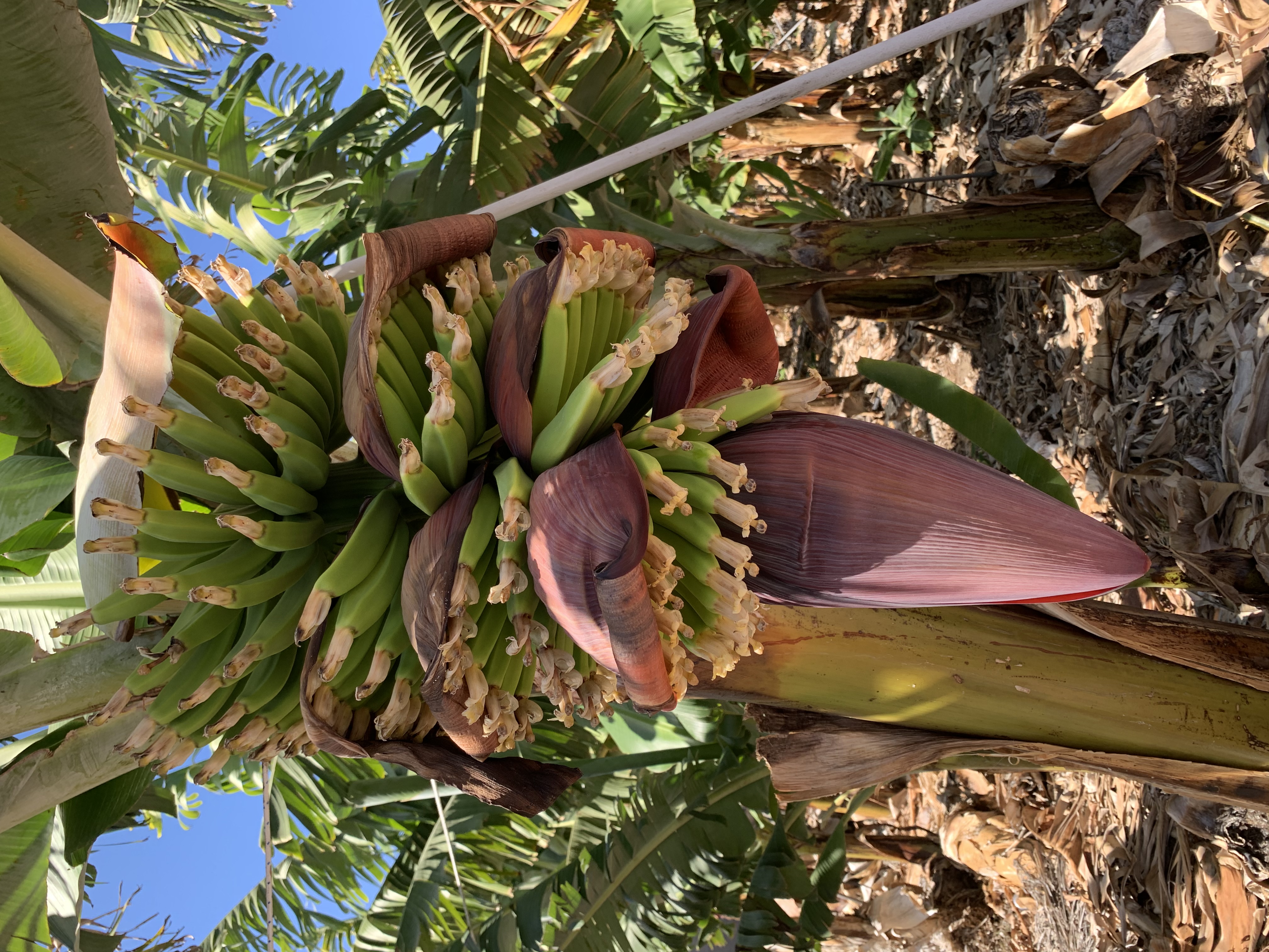
The mono banana culture of La Palma helps the growth with its wonderful rich mineral soils.
The Mediterranean volcanoes I visited were off the coast of north east Sicily or the Aeolian islands Stromboli had been active recently and volcano has smell of sulphur and thermal hot mud bathing with lots of volcanic nutrients in the mud.
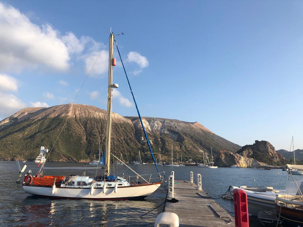
The Mediterranean volcanoes I visited were off the coast of north east Sicily or the Aeolian islands Stromboli had been active recently and volcano has smell of sulphur and thermal hot mud bathing with lots of volcanic nutrients in the mud. edges of tectonic plates, both on land and in the oceans.
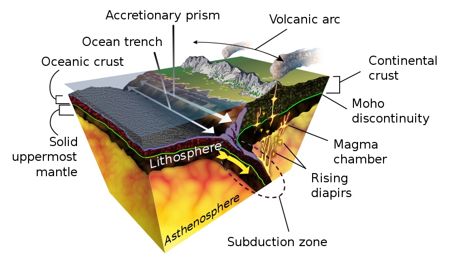
On land, volcanoes form when one tectonic plate moves under another. Usually a thin, heavy oceanic plate subducts, or moves under, a thicker continental plate. When this happens, the ocean plate sinks into the mantle.
Water trapped in the rocks in this plate gets squeezed out. This causes some of the rocks to melt. The melted rock, or magma, is lighter than the surrounding rock and rises up. This magma collects in magma chambers, but it is still miles below the surface.
When enough magma builds up in the magma chamber, it forces its way up to the surface and erupts, often causing volcanic eruptions.
In the ocean, volcanoes erupt along cracks that are opened in the ocean floor by the spreading of two plates called a mid-ocean ridge .
Magma from Earth’s upper mantle rises up to fill these cracks. As the lava cools, it forms new crust on the edges of the cracks. These mid-ocean ridges are actually long chains of underwater volcanoes that circle the planet like the seams on a baseball.
About 80 to 90 percent of all volcanic eruptions occur where the plates spread apart.
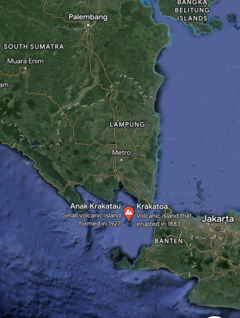
I remember in the 1969 “Krakatoa East of Java” the film drama of one biggest volcanic eruptions in the world called Krakatoa. In the Indonesian archipelago between South Sumatra and West Java. Massive eruption happened in 1883. Last erupted in 2020.
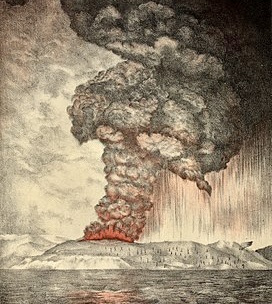
While seismic activity around the volcano was intense in the years preceding the cataclysmic 1883 eruption, a series of lesser eruptions began on 20 May 1883. The volcano released huge plumes of steam and ash lasting until late August.
On 27 August, a series of four huge explosions almost destroyed the island. The explosions were so violent that they were heard 3,110 km (1,930 mi) away in Perth, Western Australia, and the island of Rodrigues near Mauritius, 4,800 km (3,000 mi) away.
The pressure wave from the third and most violent explosion was recorded on barographs around the world. Several barographs recorded the wave seven times over the course of five days: four times with the wave travelling away from the volcano to its antipodal point, and three times travelling back to the volcano; the wave rounded the globe three and a half times.
Ash was propelled to a height of 80 km (260,000 ft). The sound of the eruption was so loud it was reported that if anyone was within 16 kilometres (10 mi), they would have gone deaf.
The combined effects of pyroclastic flows, volcanic ashes, and tsunamis had disastrous results in the region and worldwide. The death toll recorded by the Dutch authorities was 36,417, although some sources put the estimate at more than 120,000.
There are numerous documented reports of groups of human skeletons floating across the Indian Ocean on rafts of volcanic pumice and washing up on the east coast of Africa up to a year after the eruption. Summer temperatures in the northern hemisphere fell by an average of 0.4 °C (0.72 °F) in the year following the eruption.
One of the most famous historic volcanic eruptions was Vesuvius and hot para plastic ash that engulfed Pompeii in 79 AD. Which was one of the most deadly European eruptions in European history with as many as 16,000 deaths through hot gas asphyxiation.
In the autumn of 79 AD, Mount Vesuvius violently spewed forth a deadly cloud of super-heated tephraand gases to a height of 33 km (21 mi), ejecting molten rock, pulverized pumice and hot ash at 1.5 million tons per second, ultimately releasing 100,000 times the thermal energy of the atomic bombings of Hiroshima and Nagasaki.
The event gives its name to the Vesuvian type of volcanic eruption, characterised by eruption columns of hot gases and ash exploding into the stratosphere, although the event also included pyroclastic flows associated with Pelean eruptions.
At the time, the region was a part of the Roman Empire, and several Roman cities were obliterated and buried underneath massive pyroclastic surges and ashfall deposits, the best known being Pompeii and Herculaneum.
After archaeological excavations revealed much about the lives of the inhabitants, the area became a major tourist attraction, and is now a UNESCO World Heritage Site and part of Vesuvius National Park.
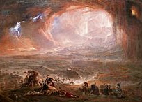
The total population of both cities was over 20,000..The remains of over 1,500 people have been found at Pompeii and Herculaneum so far, although the total death toll from the eruption remains unknown.
In the film of the May 1980 Mount St Helen’s eruption some people refused to take into account the seriousness of the potential danger of volcanic gases and the power of full scale eruption.
One of the mountain residents refused to leave and paid the ultimate price with the loss of his life. We humans can be rather ignorant of the power of nature in all its unmitigated glory.
That’s what happened in Pompeii people refused to leave didn’t understand the power of Vesuvius. Probably more people lost their lives needlessly.
I feel there is a direct parallel today with our view of climate heating as carbon dioxide in the atmosphere keeps constantly rising year on year now in 2022 CO2 is at 420 parts per million. we like to “keep kicking the can down the road” what does it take for us to take action to mitigate and stop emitting carbon dioxide into the atmosphere and the oceans.. Unfortunately one day it will be too late for us to reverse the impending catastrophe climatic situation that will behold us.
Like the people who kept ignoring the rumblings of Krakatoa and Vesuvius, then suddenly it was too late it cost them their lives! The power is with nature and not with us and the warning signs are there for us to see and are in plane sight?
Plate tectonics
Really volcanoes happen or occur at or near plate boundaries caused through subduction. What’s subduction?
Subduction
Subduction is a geological process in which the oceanic lithosphere is recycled into the Earth’s mantleat convergent boundaries. Where the oceanic lithosphere of a tectonic plate converges with the less dense lithosphere of a second plate, the heavier plate dives beneath the second plate and sinks into the mantle.
A region where this process occurs is known as a subduction zone, and its surface expression is known as an arc-trench complex. The process of subduction has created most of the Earth’s continental crust. Rates of subduction are typically measured in centimeters per year, with the average rate of convergence being approximately two to eight centimeters per year along most plate boundaries.
Subduction is possible because the cold oceanic lithosphere is slightly denser than the underlying asthenosphere, the hot, ductile layer in the upper mantle underlying the cold, rigid lithosphere. Once initiated, stable subduction is driven mostly by the negative buoyancy of the dense subducting lithosphere. The slab sinks into the mantle largely under its weight.
Earthquakes are common along the subduction zone, and fluids released by the subducting plate trigger volcanism in the overriding plate. If the subducting plate sinks at a shallow angle, the overriding plate develops a belt of deformation characterized by crustal thickening, mountain building, and metamorphism. Subduction at a steeper angle is characterized by the formation of back-arc basins.
Plate Boundaries
Continental transform faults play a critical role in accommodating strain along major tectonic plate boundaries. These strike–slip faults and their associated structures are defined by linkage of mid-ocean spreading centers and subduction zones, and are exposed onshore as they traverse the continental crust between mid-ocean ridges and other plate boundary segments.
Often times, due to the predominantly horizontal motion along transform faults, the geomorphic expression of these structures is subtle as there is generally little or no surface or rock uplift driving base level fall and river incision. However, continental transform faults generally have segments that are well-expressed geomorphically and it is these regions that tend to offer the greatest insight into transform plate boundary deformation.
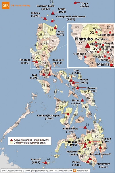
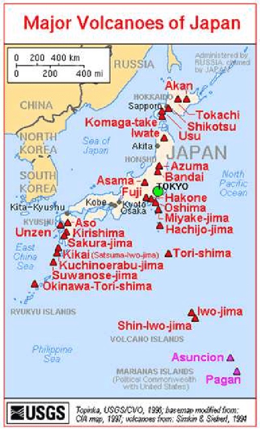
Living near volcanoes or near plate boundaries anywhere in the world is dangerous, what makes things worse in the western pacific, such as living in the Philippines or in Japan, is not only are you’re living on plate boundary with subduction zone near by, but of earthquakes, volcanic eruption and potential Tsunamis and just to cap it off you live in a powerful cyclonic hurricane regions of the north pacific ocean. To be honest not the best place to live if you value your life? I equate it to living on the edge of a war zone! But its natures war zone which is the the most powerful war zone ever.
